Skip to content

Trekking

6 Days Umbwe Route

6 Days
Availability: Year- Round
Arrival: Kilimanjaro Airport
Departure: Kilimanjaro Airport
Trekking Overview

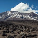
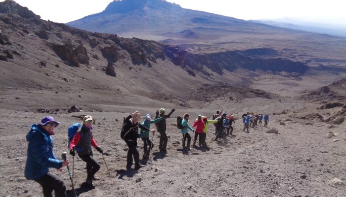
Umbwe route is one of the shortest routes to the Southern Glaciers. It is the hardest and most challenging route on Mount Kilimanjaro. The route is the trail for trekkers looking for a true climbing challenge.

The fitness and stamina of hikers may be tested along the way and it is best for experienced mountain trekkers who are looking for a challenge. This is the route to choose if you want to test yourself on the slopes of Mount Kilimanjaro.

Itinerary
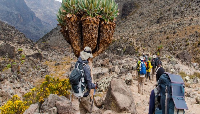
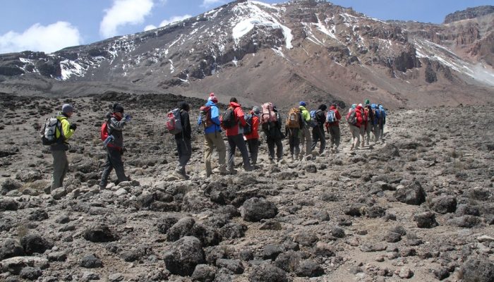
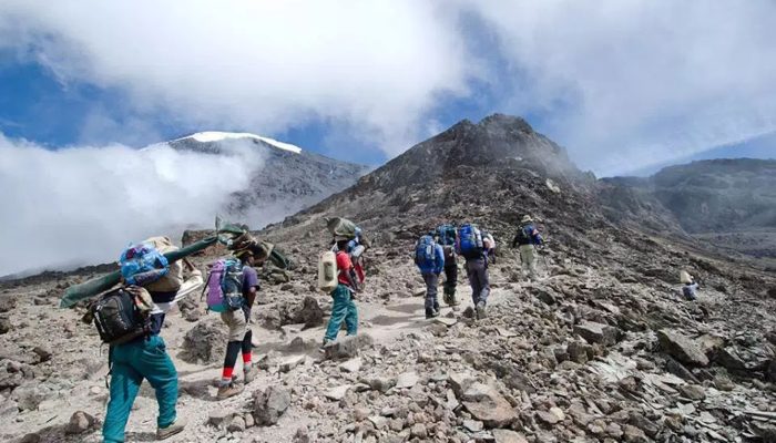
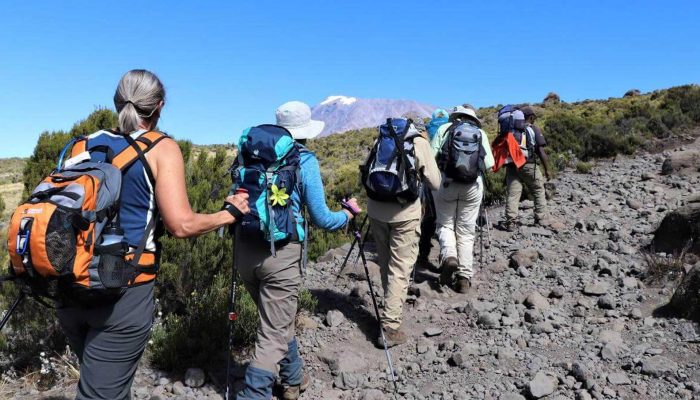
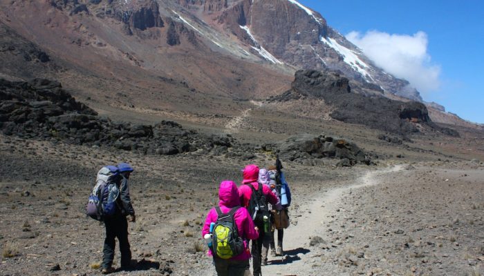
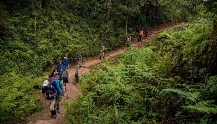
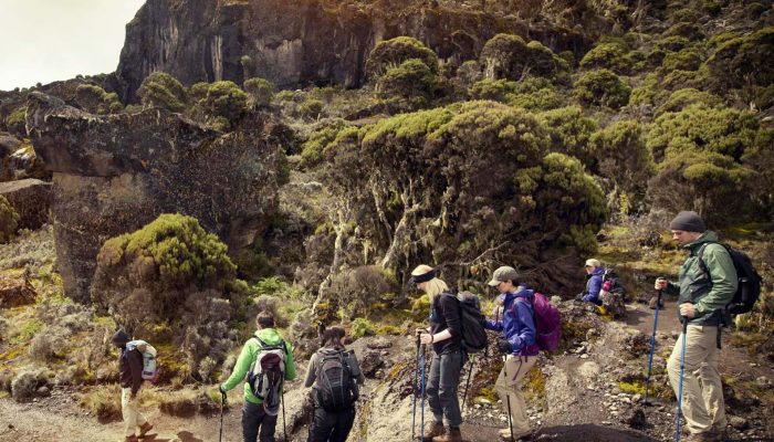
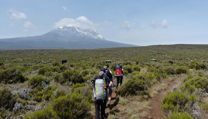
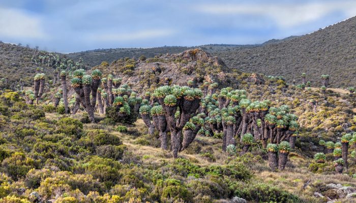
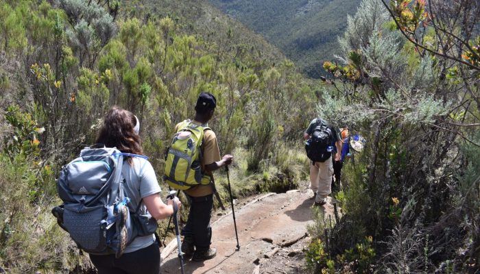
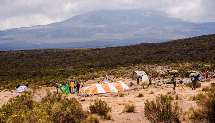
Departing from Arusha/Moshi until we reach the Umbwe gate. Enjoy the beautiful rainforest scenery and windy trails while your guide tells you about the local flora and fauna and natural wildlife.

At these lower elevations, the trail can be muddy and quite slippery. The path follows a ridge between two deep valleys up through the dense montane forest. Then we continue until we reach Umbwe Cave.

Elevation:
1800m to 2850m
Distance:
11km
Walking time:
7hours
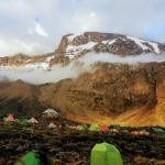
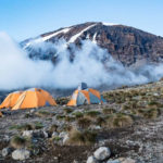
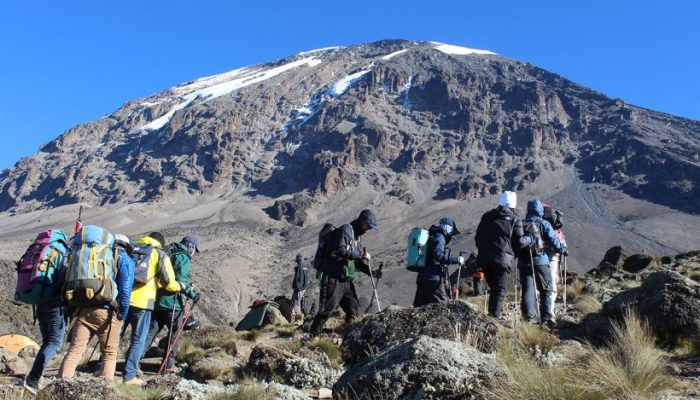
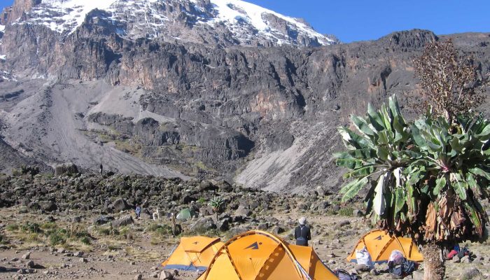
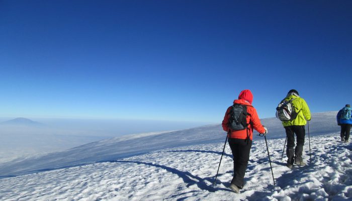
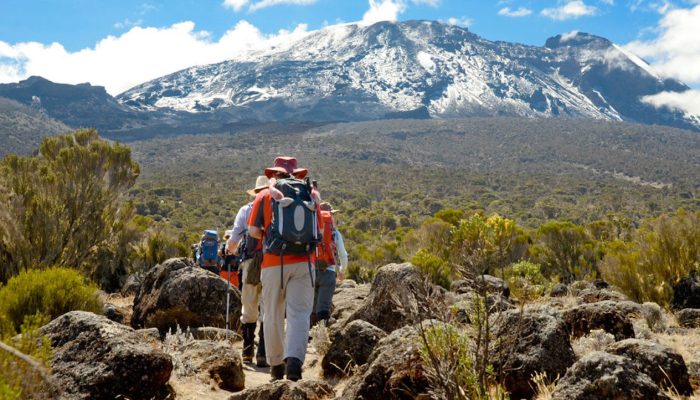
We leave camp and shortly afterward the forest ends. We can see the sheer wall of the Western Breach appearing and disappearing as the afternoon mists roll up the Great Barranco. We will camp at Barranco camp.

Elevation:
2850m to 3900m
Distance:
6km
Walking time:
7 hours
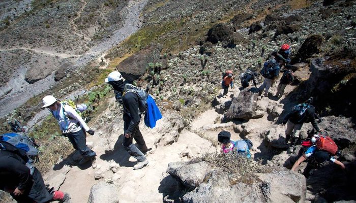
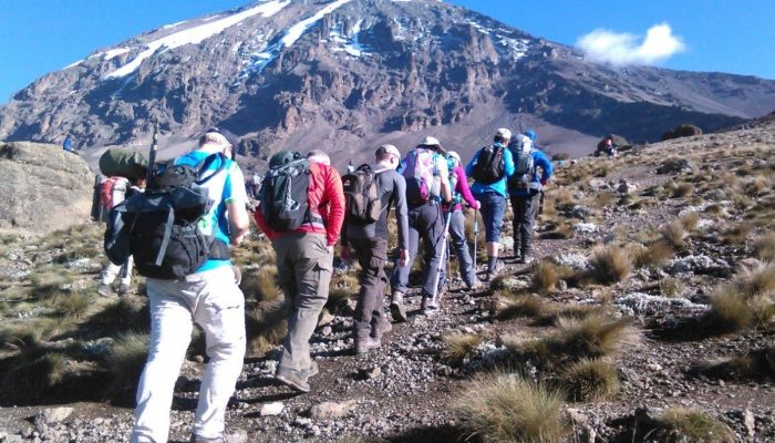
After breakfast, we continue on a steep ridge up the adventurous Barranco Wall to the Karanga Valley and the junction, which connects with the Mweka Trail. This is one of the most impressive days to see your power/ strength over this wall with what appears such ease. Overnight at Karanga Camp.

Elevation:
3900m to 3995m
Distance:
6km
Walking time:
5hours
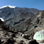
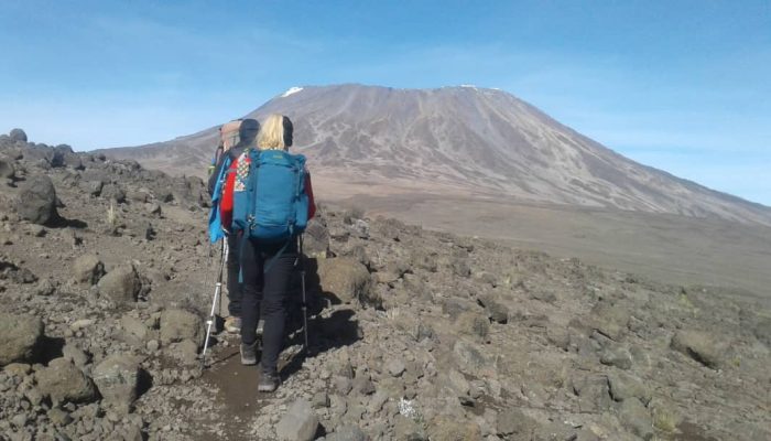
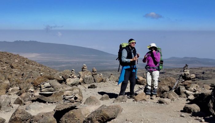
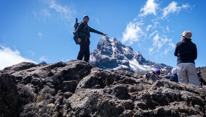
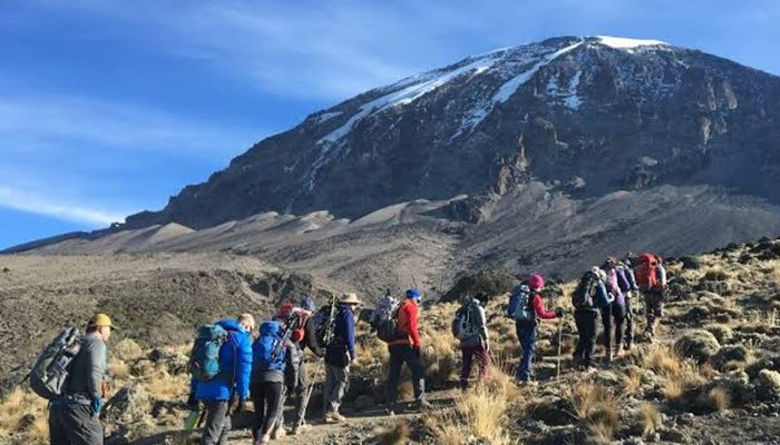
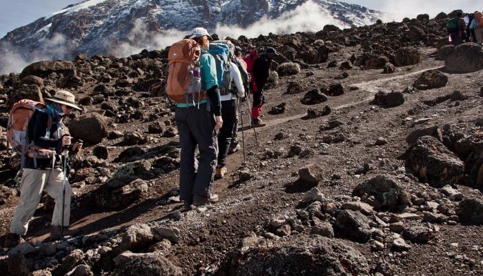
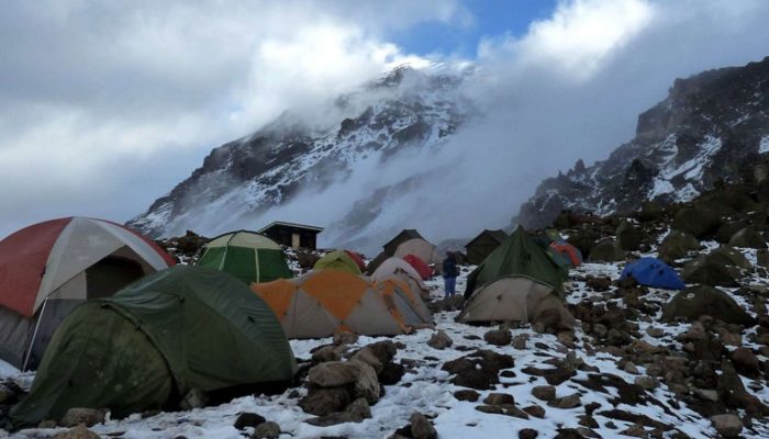
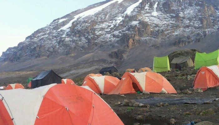
We leave Karanga camp behind to meet the junction connecting with the Mweka descent Trail. From here we continue up to the Barafu Hut. You have now completed the Southern Circuit, which offers views of the summit from many different angles.
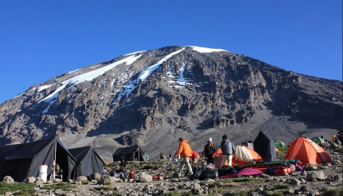
At the camp, we can rest, enjoy dinner, and prepare for the summit day. The two peaks of Mawenzi and Kibo will be seen from this position.

Elevation:
3995m to 4673m
Distance:
4km
Walking time:
5hours
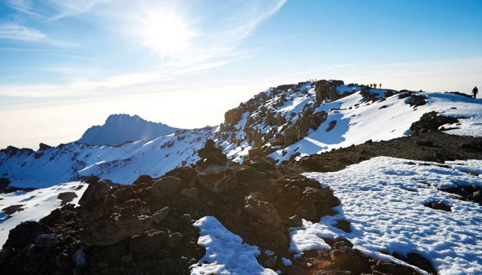
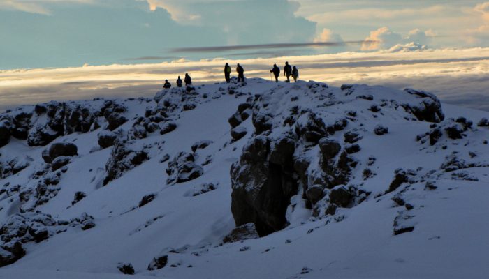
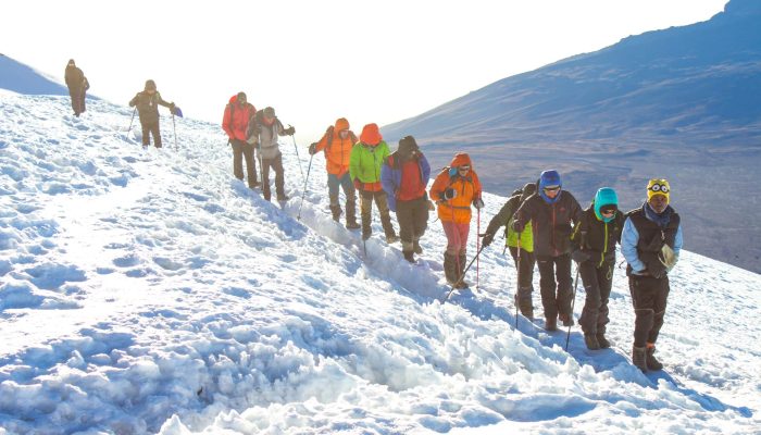
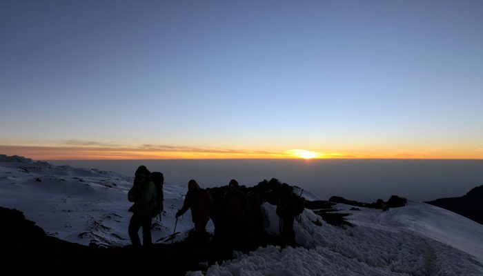
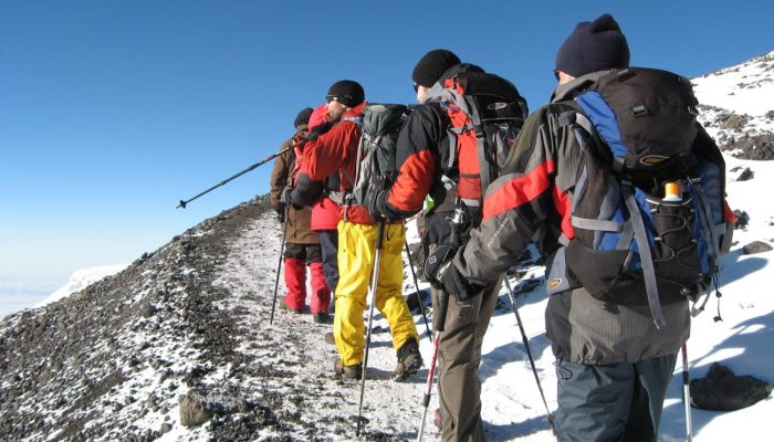
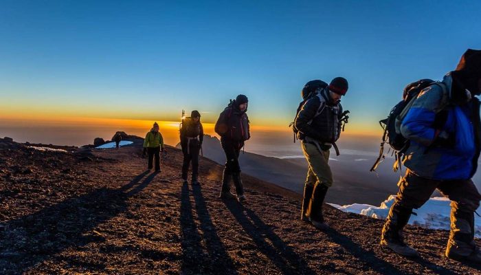
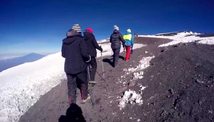
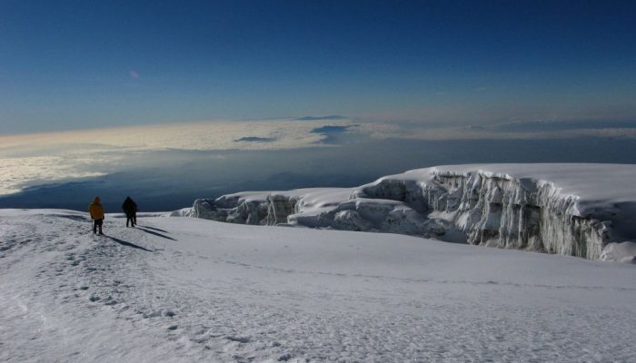
You will be woken at midnight with some quick tea and biscuits. We start our trekking to the summit. We will head in a northwest direction and ascend through to Stella Point on the crater rim.

At Stella Point, we will stop for a short rest and will be rewarded with the most magnificent sunrise. At Uhuru Peak, we will have reached the highest point on Mount Kilimanjaro and the roof of Africa.

Then we descend to the Mweka Hut camp, via Barafu for lunch. Trekking poles will be needed for the loose gravel going down to Mweka Camp. Later in the evening, we will enjoy our last dinner on the mountain and a well-earned sleep.

Elevation:
4673m to 5895m to 3100m
Distance:
5km to Uhuru and 11km to Mweka
After breakfast, it is to time to say goodbye to the crew. We continue the descent down to the Mweka Park Gate to receive your summit certificates. From the gate, a vehicle will meet you at Mweka village to drive you back to your hotel in Arusha/Moshi.

Elevation:
3100m to 1800m
Distance:
10km
Walking time:
3hours
Photos

Price

Request a Quote

WHY WORK WITH FIRST FLY SAFARIS?

Best rates in the market
Dedicated traveler care 24/7
Responsible team, responsible trave
Tailor made itineraries

Talk to our Expert

More Tours >>

6 Days Rongai Route

6 Days
Availability: Year- Round
Arrival: Kilimanjaro Airport
Departure: Kilimanjaro Airport
Trekking Overview

Rongai Route is known to be more scenic than the Marangu Route, easier than the Machame Route, and the success route. The Rongai starts on the north side of the mountain just south of the Kenyan border and is one of the least traveled routes.

The Rongai joins the Marangu for the summit climb, then you descend the Marangu Route on the mountain’s southeast side.

Itinerary
Early in the morning after breakfast, ready to start a drive of about 4 hours to Rongai gate, which lies near the Kenya border northeast of the country. Upon arrival at the gate, park formalities are taken, at this moment you can sit waiting for lunch or make a move around the area.
The rainforest with your eyes open, possibly spotting some blue monkeys swinging on the tree branches. Then proceed to Simba Cave for dinner and overnight.

Elevation:
1997m to 2635m
Distance:
6km
Walking time:
4 hours
After breakfast, our hike continues through the moorland zone where you will notice the vegetation changes to shrubs and grasses. You will stop for lunch at the second cave where we meet at the junction to the third cave and the Kikelelwa Camp.
You will then turn east towards Kikelelwa Camp for dinner overnight.

Elevation:
2620m to 3600m
Distance:
9km
Walking time:
7 hours
A short but steep climb up grassy slopes is rewarded by superb views. Leave the vegetation behind shortly before reaching the next camp at Mawenzi Tarn, spectacularly situated in a cirque directly beneath the towering spires of Mawenzi.

The afternoon will be free to rest or explore the surrounding area as an aid to acclimatization. If you are spending an extra day on the mountain, you will camp for two nights here. You can hike up and around Mawenzi for your acclimatization hike.

Elevation:
3600m to 4330m
Distance:
4km
Walking time:
4 hours
A beautiful lunar landscape is crossed today, after the ascent to the higher camp. The Kibo Camp is located directly below Kibo summit, from where you can enjoy a spectacular view of the Kenyan plain.

Here you can also see Mawenzi and the path very well. After lunch, you can rest and regain your strength because the next day you will do the summit day to the peak of Kilimanjaro.

Elevation:
4330m to 4700m
Distance:
9km
Walking time:
6 hours
The day begins at midnight, you will be woken up with a hot cup of tea and a biscuit before you begin your ascent in the dark.

We will then continue taking our way up to Gilman’s Point. Standing on this crater rim, you will take a short break, take on some water and rest a little before you cross the crater to Stella Point. We will then gradually make our way to Uhuru Peak, where you will be able to witness the incredible views, stay for a picture, and enjoy your great achievement while standing on the roof of Africa.

We will then descend straight down the mountain towards the Kibo Hut where we will stop for a rest, lunch, and a celebration before heading back down towards Horombo Hut.

Elevation:
4700m to 5895m to 3720m
Distance:
16km
Walking time:
12 hours
We continue to descend, stopping at the Mandara Huts for lunch. Then return to Marangu Gate and receive your summit certificates. From the gate, a vehicle will meet you to drive you back to your hotel in Arusha/ Moshi.

Elevation:
3720m to 1830m
Distance:
18km
Walking time:
7 hours
Photos

Price

Request a Quote

WHY WORK WITH FIRST FLY SAFARIS?

Best rates in the market
Dedicated traveler care 24/7
Responsible team, responsible trave
Tailor made itineraries

Talk to our Expert

More Tours >>

9 Days Northern Circuit Route

9 Days
Availability: Year- Round
Arrival: Kilimanjaro Airport
Departure: Kilimanjaro Airport
Trekking Overview

The Northern Circuit Route is the new Route to create a lifetime experience in your memory. You will have the chance to ascend to more scenic and take your way to the western slopes, then cross the entire mountain before the summit.

The route is the most easiest and friendly route as you have enough days for gently trekking up to the highest peak of Africa.

Itinerary
Early in the morning after breakfast, we commence our safari to the western side of Kilimanjaro, until we reach the Londorossi Gate. After the check-in formalities are complete, then we begin the climb through the mountain forest.
Upon reaching the first camp we will rest under the forest canopy and enjoy the sounds of birds and velvet monkeys.

Elevation:
2100m to 2850m
Distance:
6km
Walking Time:
4 hours
Today we leave the rainforest and enter the heath and moorland zone. It is a great day for beautiful views that reach the rim of the Shira Plateau and enjoy the stunning views from the ridge. We may have continuous short breaks, to make your body fit, then later we will camp at Shira 1 camp.

Elevation:
2850m to 3505m
Distance:
8km
Walking Time:
6 hours
What a pretty trekking day! They used to say practice makes perfect. Hence today is acclimatization day and a very short day in terms of terrain and elevation.
We’ll look to climb about 350m/1,148ft very gentle trekking. During this day you will have a chance to explore the Shira Plateau and enjoy a view of Kibo.

Elevation:
3505m to 3840m
Distance:
7km
Walking Time:
4 hours
After the acclimatization you had, now continue ascending to Lava Tower. This is a very important day for your progress up to Kilimanjaro. Then you will receive your lunch when reaching the Lava Tower. Rest a bit and descend to Moir Hut.

Elevation:
3840m to 4600m to 4200m
Distance:
12km
Walking Time:
8 hours
We commence a moderately steep climb out of Moir Valley. The route follows a series of slopes until we reach Kibo then Buffalo Camp. When arriving at Buffalo Camp, you will have lunch and time to rest ready for the next day.

Elevation:
4200m to 4033m
Distance:
12km
Walking Time:
6 hours
The day starts with a climb up the Buffalo Ridge and down into Pofu Camp, then you will have your lunch there. We continue the Eastward around the Northern slopes to the Rongai Third Cave.
Today’s climb is a bit shorter than the day before and you should be feeling better at this point. You will arrive at the Third Cave around midafternoon.

Elevation:
4033m to 3936m
Distance:
5km
Walking Time:
7 hours
We continue ascending until we see a pretty view of Kibo and Mawenzi. From here we continue upwards until we reach the School Hut in the early afternoon. Get enough relaxation and prepare for the summit day.

Elevation:
3936m to 4800m
Distance:
10km
Walking Time:
7 hours
We commence the last day and the more demanding part of trekking. Then we continue taking our way up to the crater rim at Gillman’s Point. We take a short rest and enjoy the spectacular sunrise over Mawenzi.

We then head on to Uhuru peak. We continue with our journey up to Stella Point and then descend through Barafu Camp to reach Mweka Camp.

Elevation:
4800m to 5895m to 3106m
Distance:
6km to Uhuru 13km descend to Mweka
We finish our trekking through the lush forest as we descend to the Mweka Gate. At the gate, we will collect our summit certificate, then the vehicle will transfer you back to Arusha/Moshi.

Elevation:
3106m to 1640m
Distance:
10km
Walking Time:
3 hours
Photos

Price

Request a Quote

WHY WORK WITH FIRST FLY SAFARIS?

Best rates in the market
Dedicated traveler care 24/7
Responsible team, responsible trave
Tailor made itineraries

Talk to our Expert

More Tours >>

6 Days Marangu Route

6 Days
Availability: Year- Round
Arrival: Kilimanjaro Airport
Departure: Kilimanjaro Airport
Trekking Overview

Marangu Route “The coca-cola route” is considered to be one of the easiest paths to the summit, given its gradual slope and direct path. Our expert guides will ensure everything goes smoothly from top to bottom while you enjoy the adventure of Kilimanjaro trekking. Being only 6 days long, it can be slightly more challenging to acclimatize because the paths are more direct than others.

Itinerary
We depart Arusha/Moshi early in the morning to Marangu Gate for the necessary formalities before beginning our trekking. The hiking trail begins by ascending a beautiful, tropical rainforest.

At the upper edge of the forest line, we have the opportunity to see blue monkeys. The trail then winds its way along the beautiful hillsides until we reach the Mandara Hut.

Elevation:
1842m to 2700m
Distance:
8km
Walking time:
5hours
After breakfast, we will begin today’s trekking through the forest until we reach the moorlands. We may get our first views of the Kibo and Mawenzi peaks, two of the three volcanic peaks that make up the summit of Kilimanjaro.

Elevation:
2700m to 3720m
Distance:
12 km
Walking time:
8 hours
This day is specifically designed for acclimatization. We will enjoy a pleasant hike to the Mawenzi Ridge which offers expansive views over Kibo and Mawenzi. After enjoying a few moments exploring the area, we’ll then head back to Horombo Hut.

Elevation:
3720m to 4390m to 3720m
Distance:
5km to and 5km back
Walking time:
5 hours
Today is a 10km walk but it is gradual. We will cross over the saddle between Mawenzi and Kibo before we reach the Kibo Hut. The camp sits at the bottom of the Kibo crater wall and once we get there, will enjoy an early dinner before preparing for the summit day.

Elevation:
3720m to 4700m
Distance:
10km
Walking time:
8 hours
Very early in the morning (around midnight), you will be gently woken up with a hot cup of tea and some snacks before we begin our final day at the summit. The wind and cold at this elevation and time of day can be extreme.

While taking short, frequent breaks, we will be walking in darkness for several hours. Once we reach Gilman’s Point, you will be rewarded with the most magnificent sunrise you are ever likely to see coming over Mawenzi Peak.

Finally, we arrive at Uhuru Peak, the highest point on Mount Kilimanjaro and the roof of Africa. After spending a few moments taking in the plains of Tanzania and your accomplishment, we descend to Horombo Hut.

Elevation:
4700m to 5895m to 3730m
Distance:
6km to Uhuru and 16km from Uhuru to Horombo Hut
On our last day, we will have a long, steady trek down through the tropical forest. Upon arrival at the gate, we will collect our summit certificates and enjoy a well-earned initiative. Our driver will be waiting to meet us at Marangu gate and transport us back to the hotel in Arusha/Moshi Town.

Elevation:
3730m to 1842m
Distance:
20km
Photos

Price

Request a Quote

WHY WORK WITH FIRST FLY SAFARIS?

Best rates in the market
Dedicated traveler care 24/7
Responsible team, responsible trave
Tailor made itineraries

Talk to our Expert

More Tours >>

6 Days Machame Route

6 Days
Availability: Year- Round
Arrival: Kilimanjaro Airport
Departure: Kilimanjaro Airport
Trekking Overview

Machame route “Whiskey route” is one of the best routes to climb, both in terms of acclimatization and cost. The route is considered a more difficult route and is a better route for adventurous trekkers/climbers and those with some hiking experience.

It is a more Popular Route for climbing Kilimanjaro than all. The route approaches the summit from the southwest and descends using the Mweka route. In a certain section, this route is steeper than the Marangu and Rongai routes and physically more attractive, great for acclimatization with lots of walks high.

Itinerary
Drive from Arusha/Moshi to Machame Gate. The journey passes through the Machame Village located on the lower slopes of Mount Kilimanjaro. Then reach the park gate and walk through the rainforest up to a ridge.

At lower elevation points the route trail can be muddy and slippery. Then we continue a very short distance until we reach the Machame Camp for Dinner and overnight.

Elevation:
1830m/6000ft to 3050m/9950ft
Distance:
11km
Hiking Time:
5 to 6 hours
Habitat:
Montane Forest
Meals:
Dinner and Breakfast
After breakfast, we leave Machame camp and continue with ascending path, then passing through the valley along a steep rocky ridge. We proceed to ascend more to the west side until we arrive at Shira camp.

Elevation:
3050m/9950ft to 3850m/12,600ft
Distance:
5km
Walking Time:
4 to 5 hours
Habitat:
Moorland
Meals:
Breakfast, Lunch, and Dinner
Early in the morning, we leave Shira Camp, then we continue to the east up to a ridge, crossing the junction towards Kibo’s Peak. As we continue, we take the southeast direction to the Lava Tower.
Then we continue with our Journey down to Barranco Camp. This day is very important for acclimatization and will help you ready for the summit day.

Elevation:
3850m/12,600ft to 4000m/13,000ft
Distance:
10km
Walking Time:
5 to 6 hours
Habitat:
Semi-desert
Meals:
Breakfast, Lunch, and Dinner
We leave Barranco Camp after breakfast and continue on a steep ridge up to the Barranco Wall, passing through the Karanga Valley to the junction which connects with the Mweka Trail.
Then we continue up to the Barafu Camp. When reaching the Barafu Camp you have the chance to see the views of the summit from many different angles.

Elevation:
4000m/13,000ft to 4700m/15,350ft
Distance:
9km
Hiking Time:
6 to 8 hours
Habitat:
Alpine Desert
Meals:
Breakfast, Lunch, and Dinner
Very early in the morning (midnight) we make our way to the summit between the Rebmann and Ratzel glaciers. We take the northwest direction and ascend until we reach Stella Point on the crater rim. Reaching this point is the most challenging portion of trekking.

At Stella Point, you will stop for a short rest and will be rewarded with the most magnificent sunrise. Quick hikers may view the sunrise from the summit. From Stella Point, you may encounter snow on your 1-hour ascent to the summit. Once at Uhuru Peak you have reached the highest point on Mount Kilimanjaro and the roof of Africa!

From the summit we begin our descent by continuing straight down to the Mweka Camp, stopping at Barafu for lunch. Then after arriving at Mweka Camp, enjoy our last evening on the mountain.

Elevation:
4700m/15,350ft to 5895m/19,340ft Down to 3090m/10,150ft
Distance:
5km/3mi up / 13km/8mi down
Hiking Time:
5-7 hours up / 5-6 hours down
Habitat:
Stone scree and ice-capped summit
Meals:
Breakfast, Lunch, and Dinner
After breakfast, we continue our descent down to Mweka gate to receive your summit certificates. At lower elevations, it can be wet and muddy. Extreme Wilderness Adventure vehicles will be waiting for you at Mweka gate to drive you back to your hotel in Moshi.

Elevation:
3090m/10,150ft to 1680m/5500ft
Distance:
10km
Hiking Time:
3 to 4 hours
Habitat:
Forest
Meals:
Breakfast
Photos

Price

Request a Quote

WHY WORK WITH FIRST FLY SAFARIS?

Best rates in the market
Dedicated traveler care 24/7
Responsible team, responsible trave
Tailor made itineraries

Talk to our Expert

More Tours >>

8 Days Lemosho Route

8 Days
Availability: Year- Round
Arrival: Kilimanjaro Airport
Departure: Kilimanjaro Airport
Trekking Overview

Lemosho route is also among the popular route and one of the scenic routes on Mount Kilimanjaro. The route is one of the least crowded routes on Mount Kilimanjaro.  The route is very cool and hence creates attention from the Majority of Visitors.

You will never forget the quiet stunning Landscape and attractions on the way up, as you make your way to Uhuru Peak. Lemosho is a superb route for your climbing. The proposed 8 trekking days will give you better chances for acclimatization and give you success on your trekking.

Itinerary
After breakfast we depart Arusha/ Moshi to Londorossi Gate, then after entry formalities completion, we drive to Lemosho trailhead, upon arrival we begin the hiking through the cool forest and make our way up until we reach the first camp. On the way up, you may see many attractions including the blue monkeys jumping and playing in the trees.

Elevation: 2,460m to 2,895m
Distance: 6 km
Walking time: 4 hours
We continue ascending the trail leading to the rainforest and tall grasses in Savannah land. As we continue ascending through the rolling hills, we reach the Shira Ridge before dropping slowly down to Shira 1 Camp. Here we catch our first glance of Kibo across the plateau.

Elevation:
2895m
Distance:
8 km
Walking time:
5 hours
Today is a pretty day as we will spend a full day exploring one of the highest plateaus on earth the Shira Plateau. Then proceed with a gentle walk up to Shira 2 Camp. We then take another direction from the main trail to Moir Hut. Several walks are available on Lent Hills marking the day as excellent for acclimatization.

Elevation:
3505m
Distance:
11 km
Walking time:
6 to 8 hours
Today is a pretty day for acclimatization over the route as trekkers trek high from 4206m to about 4629 m above sea level and overnight at a low elevation point at Barranco Camp which is 3960 m above sea level.

Elevation:
4206m to 4629m to 3960m
Distance:
10 km
Walking time:
9 hours
Early in the morning after breakfast, we commence hiking up to the great Barranco wall for approximately 1 hour, a steep wall but not difficult, passing through the famous rock. Have a short break enjoying your snacks with some water while taking some photos.

Due to weather, the mountain peak can be seen clearly from this point. After a short break, we proceed to look forward to descending and ascending the Karanga valley before we reach the camp for lunch.

Elevation:
3963m to 3994m
Walking time:
5 hours
Early in the morning, we are leaving Karanga camp, we continue trekking through the rock ridges until we connect our trail with the Mweka Trail. We proceed trekking to Barafu camp where we will have our lunch and enjoy an early dinner. Then prepare yourself for the summit day.

Elevation:
3994m to 4673m
Distance:
4km
Walking time:
5 hours
Today we wake up very early at midnight, then we begin our summit day trekking. We ascend in the darkness for several hours while taking frequent but short breaks. Near Stella Point, you will be rewarded with the most magnificent sunrise.

Then finally, we arrive at Uhuru Peak, the highest point on Mount Kilimanjaro and the roof of Africa. Take a few pictures and enjoy your achievements. Then we now descend straight down to the Mweka Hut campsite. Later in the evening, we will enjoy our last dinner on the mountain.

Elevation:
4673m to 5895m
Distance:
5 km
Walking time:
7 hours
Today marks the end of our trek for the 8 days trekking program. When reaching the Mweka gate we will collect Kilimanjaro summit Certificate, then the vehicle will be ready to pick us up back to the hotel in Arusha/ Moshi.

Elevation:
3067m to 1639m
Distance:
10 km
Walking time:
3 to 4 hours
Photos

Price

Request a Quote

WHY WORK WITH FIRST FLY SAFARIS?

Best rates in the market
Dedicated traveler care 24/7
Responsible team, responsible trave
Tailor made itineraries

Talk to our Expert

More Tours >>